
Our heavyweight helicopter equal in the world does not have
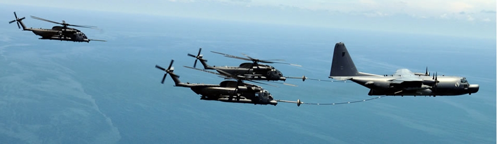
In Rostov started production of the most load-lifting rotary-wing car The Russian holding «Helicopt[...]

Everything about aircrafts and helicopters. News and events in aviation worldwide. Civil, transportation, military helicopters and airplanes.
Everything about aircrafts and helicopters. News and events in aviation worldwide. Civil, transportation, military helicopters and airplanes.
Everything about aircrafts and helicopters. News and events in aviation worldwide. Civil, transportation, military helicopters and airplanes.
Everything about aircrafts and helicopters. News and events in aviation worldwide. Civil, transportation, military helicopters and airplanes.


Clouds are classified according to two criteria—the amount of air movement in them and the altitude at which they typically form. Although one of the two criteria is often enough to designate a cloud type, a combination of the two is also sometimes used.
|
On Course |

What’* it like inside a cloud? You’ve already seen it a hundred time*—in the form of fog.
Though we give fog its own name and pay a good deal of attention to it in local weather broadcasts, the insides of a cloud are identical to being in the middle of a fog bank. When flying in a cloud, the sensation ranges from featureless gray to bright white to intermittent flashes of blue sky alternated with white tendrils of cloud. It all depends on the type of cloud you’re in and how close you fly to its upper boundary.
Clouds that feature air movement in the form of updrafts and downdrafts—vertical movement called convection—develop tall, billowy tops. They are called cumulus clouds, and can lend a bright, textured feeling to the sky. Convection is caused by the sun heating the earth’s surface, or by cold air moving over a warm surface.
Clouds that form in relatively still air—air that has very little convection—are called stratus clouds, and are usually flat and slate-gray in appearance. As you might guess, cumulus clouds, to a pilot, signal the presence of unstable air, while stratus clouds signal the presence of stable air.
Clouds that possess little air movement but that form in high, cold altitudes are called cirrus clouds. Cirrus clouds are thin and wispy and are made entirely of tiny ice crystals.
Below the cirrus clouds are the middle-altitude clouds designated by the prefix “alto.” If the midlevel cloud is unstable—that is, filled with convection currents—it is called altocumulus. If it is stable and is more horizontal than vertical, it is called altostratus.
Р эпе Та к
High-altitude aircraft somebmes create their own clouds. Vapor trails, or condensation trails, form in the exhaust plumes of jet engines when the water vapor contained in the exhaust condenses in the cold air. The vapor condenses into icc crystals, which can last for hours
Low clouds are simply called stratus, cumulus, or stratocumulus, meaning a scattering of lumpy, cotton-ball clouds across a wide expanse of sky, all at the same altitude, or stratum.
|
|
Turbulence
Think the study of weather is all about fluffy clouds and snow showers? Think again. Meteorology is among the most complex of all sciences, defying even the most powerful computers, which can’t precisely predict weather beyond a couple of days into the future. As technology improves, forecasting gets a little better, but weather forecasting will always be a mixture of science and bettrng the odds.
Rain clouds get their own prefix—“nimbus.” Any cloud that rains is designated with “nimbus,” for example, nimbostratus and cumulonimbus. As you might guess based on the names, nimbostratus rain clouds are mostly flat and stable. Rain from these clouds can continue for hours or days at a time. Cumulonimbus rain clouds tend to have massive, dark-gray bodies, and can tower to heights of 50,000 feet or more. They rain in sporadic showers, and have powerful up – and downdrafts that can tear the strongest airplanes to pieces.
To the seasoned cloud-watcher, every cloud carries important information. I once ignored a telltale tendril of vapor, or virga, drifting downward from the base of a cumulus cloud, and it almost cost me my life. That seemingly innocent wisp of moisture, which signifies a rain shaft that evaporates before hitting the ground, should have told me of a potentially strong downdraft that almost always accompanies virga.
Because I didn’t read the cloud accurately, I flew into a strong downdraft when I was just a couple hundred feet above the ground on approach to land. The powerful burst of air threw my plane almost into the ground, and if I were any lower, I would have crashed.
I was lucky that time and came away badly shaken but unhurt. Since then, I’ve become a much closer reader of the lessons the clouds can teach if we watch them closely.


