On the Grid: Latitude and Longitude
Latitude and longitude represent a set of imaginary grid lines that give map makers, or “cartographers,” a system for pinpointing any location on the surface of the earth. The horizontal lines on this imaginary grid are the lines of latitude; the verticalrunning lines are the lines of longitude.
|
By the Book Mathematicians and cartographers, following the lead of the ancient Greek inventors of geometry, divide circles into 360 equal divisions called degrees of arc, which are further divided into 60 minutes of arc. Each minute of arc is divided into 60 seconds of arc. |
Latitude
Midway between the earth’s North and South Poles is the equator. The equator is a line whose points are all at equal distances from both poles. It divides the globe into Northern and Southern Hemispheres and can be thought of as the starting point for latitude. The equator is the line of zero degree latitude, and every location north and south of the equator is measured in degrees, minutes, and seconds of arc.
Each degree of distance in a northerly or southerly direction from the equator is about 69 miles in width, meaning each minute of arc is a bit over a mile wide. That means you cross one second of latitude for every 101 feet you travel in a northerly or southerly direction.
Longitude
But longitude is not quite so simple to explain. That’s because lines of longitude aren’t parallel to each other the way lines of latitude are. In the case of latitude, each line is parallel to the equator and parallel to each other. In fact, we sometimes call lines of latitude “parallels.” But lines of longitude, or “meridians,” as they are also called, converge at the poles. All 360 of them meet at the North and South Poles in a space that can theoretically has no distance at all. If you stood at one of the poles, you could walk around all 360 degrees of longitude in a few steps.
Lines of longitude converge at the poles because they were conceived as running north and south. Because every north-bound trip ends at the North Pole—going any farther would be a south-bound trip—the lines of longitude end at the poles, too.
At the equator, the degrees of longitude are 69 miles apart, as wide as degrees of latitude. When you move north or south, however, the degrees of longitude grow narrower, since they all have to meet at the poles. That s why aeronautical sectionals and other maps feature perfectly parallel latitude lines but curving longitude lines.
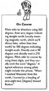
Though latitude and longitude form the fabric of our mapping and navigation methods, pilots don’t often refer specifically to them. Instead, they refer to compass directions, or “azimuth,” and the time and distance of flight. These terms suffice to convey the important aspects of navigation for pilots.
|
|


