Category Flying and Gliding

When Air’s Not There

The rare air at high altitude can take a toll on pilots. In extreme conditions, for example at altitudes above 10,000 feet, the thin air starts affecting the way the body operates.

When Air's Not There

By the Book

Hemoglobin is the molecule in red blood cells that picks up oxy­gen in the lungs and carries it to the parti of the body that need it

The ability of the blood to carry oxygen to the body’s cells, most importantly to the brain cells, is directly related to how much oxygen is carried in the blood’s hemoglobin.

Doctors describe the lack of oxygen as hypoxia. Hypoxia is a catch-all term that is associated with a number of maladies and conditions, from dizziness to

stroke. In the cockpit, we’re usually concerned with four kinds of hypoxia: anemic, histotoxic, stagnant, and hypoxic. (Yes, I agree that hypoxic hypoxia sounds repetitively redundant, but that’s what physicians call it.) Here’s a brief description of each:

• Anemic hypoxia happens when the blood has too little hemoglobin. Even if anemia doesn’t cause problems by itself, such as the shortness of breath and lightheadedness that a doctor might be concerned about, it can add to the problems caused by other types of hypoxia.

• Histotoxic hypoxia happens when another substance fills the hemoglobin molecule, robbing it of its ability to carry oxygen. Alcohol and carbon monoxide can bring on this form of hypoxia.

When Air's Not There

Turbulence

Cigarette smoke contains carbon monoxide. In fact pilots who smoke walk around in a perpetual state of histotoxic hypoxia. The poisoning of the blood makes the body feel as though it’s 5,000 feet higher than it is, at least in terms of the amount of oxygen carried by the hemoglobin.

When Air's Not There

Turbulence

It’s logical that too little air can be dangerous, but what about too much air? Yes, hyperoxia, or as it’s better known, hyperventi­lation, can cause trouble in the cockpit Rapid breathing, usually caused by anxiety and common among beginning student pilots, overfills the blood with oxygen and can cause fainting if it goes on too long. The cure is simply to consciously slow your breath­ing rate.

• Stagnant hypoxia occurs when a pilot pulls high g-forces that happen during steep turns or in aerobatic maneuvers. During high g maneuvers, the blood rushes away from the head and brain and pools in the feet and rear end.

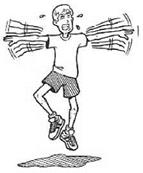
Experienced pilots use the muscles in their neck and chest to try to prevent the blood from leaving their head. In what the military cryptically calls the “L1 maneuver,” pilots strain their neck and chest muscles, which sometimes causes a grimacing facial expression. When they are contracted, the muscles pinch off the blood vessels that pass through them, preventing the blood from moving through too quickly and causing it to stay longer in the brain, where it’s needed.

• The most threatening kind of hypoxia for pilots is the hypoxic variety. As atmospheric pressure drops, so does the partial pressure of oxygen. When the partial pressure can no longer fully saturate the hemoglobin, the body starts to slowly suffocate. The brain, which uses the largest proportion of oxygen, suffers the most.

When Air's Not There

Plane Talk

I was fortunate enough to spend a day at Williams Air Force Base in Arizona experiencing the effects of high altitudes. Inside a sealed pressure chamber, technicians gradually pumped the air out of the chamber unb’l we were at simulated altitudes that went as high as 20,000 feet or so. The purpose of the training was for pilots to recognize the individual patterns of symptoms. My first symptoms were a tingling in my fingers, numbness in my lips, a dimming of vision, and a sensation of anxiety. I also discovered that, although I was in excellent condition, my tolerance for high altitudes was far less than many of the less fit and older pilots who were with me in the chamber.

Hypoxic hypoxia is dangerous because the first symptoms are often difficult for a pilot to detect. To make matters worse, the first symptom is sometimes euphoria, a sensation that everything’s just fine. In fact, unless the pilot descends to a lower altitude quickly, or puts on an oxygen mask that feeds pure oxygen, the hypoxia is likely to get worse. If something’s not done to get more oxygen to the brain, hypoxia can be fatal.

When Air's Not There

On Course

I once had a friend who man­aged, by flying mostly in the morning when the air was calm, to make it almost all the way through his airline pilot training despite the fact that he suffered from extreme, chronic airsickness. It was when he was in his final phase of training that an instruc­tor put two and two together. My friend’s airline hopes came to an end, all because of a case of incurable airsickness.

Hypoxic hypoxia often causes blue lips, blue finger-nails, tunnel vision, and shortness of breath. Pilots are taught to recognize these dangerous warning signs before disaster strikes.

A Little Pressure

In addition to its higher pressure, the lower atmosphere has a higher partial pressure, which is the amount of a gas that will dissolve into a liquid. In essence, the total pressure of the air is the sum of the partial pressures of oxygen and nitrogen. The greater the partial pressure of a gas, the more of it will be pushed into a liquid. In the case of the human body, we’re most concerned with the amount of oxygen that dissolves into our blood, which transports the oxygen to the body’s cells.

Remember, oxygen, which the body uses to fuel most of its key physiological functions, represents only about 21 percent of the make-up of the air, while nitrogen, which the body hardly uses, comprises most of the rest of the atmosphere. So oxygen, which amounts to about a fifth of the gas in the air, exerts only about a quarter of the 14.7 pounds per square inch of the total pressure. (The reason a fifth of the gas exerts a quarter of the partial pressure is that oxygen weighs more than nitrogen.)

As air pressure gets lower, the partial pressure of the gases that make it up also decreases. In human terms, that means the oxygen that is so important to running the body has a harder time getting “pressed” into the bloodstream because of the lower partial pressure.

A Little Pressure

Plane Talk

In addition to providing the lifting force that permits us to fly, the atmosphere also acts as an effective radiation filter and a shield from falling objects. It helps destroy small stones and ice particles from space before they thump us on the head, and it filters out some of the sun’s damaging rays that can cause cancer. Airline pilots and flight attendants are thought to have a higher rate of some types of cancer because they spend so much fame in the high atmosphere, where the sun’s rays are not fully filtered. Most passengers, though, don’t need to worry because they don’t spend enough time in the air for the radiation to have Tasting effects.

A Lot of Pressure

Gravity pulls the atmosphere toward the earth. The air near the earth’s surface compresses, creating greater air pressure near the earth and lower air pressure at higher altitudes. Because of the pressure exerted on the lower atmosphere, it is packed much more densely than the thin air at higher altitudes. In fact, of the roughly 180 miles-thick layer of atmosphere, fully 80 percent of it is packed into the lowest 3% miles.

At sea level, atmospheric pressure amounts to about 14.7 pounds per square inch. The higher we go in the atmosphere, the lower the pressure gets, until at the very top of the atmosphere, the air pressure diminishes to about zero.

A Lot of Pressure

Plane Talk

The air, like any gas, is composed of tiny atoms that speed through space bouncing into other atoms. Not only do atoms bounce into each other, they also bounce against every other surface, whether it’s our skin, the walls of a building, or the body of an airplane. The combined force of these tiny collisions is called atmospheric pressure, or simply air pressure. We measure pressure by comparing the total push of all the little collisions over a certain surface area, usually in units of pounds per square inch.

Meteorologists measure air pressure using instruments called barometers, which measure pressure with long mercury-filled tubes. The higher the air pressure, the higher the mercury rises in the tube. Mercury barometers measure pressure in units called inches of mercury, the units pilots most commonly use. The equivalent of 14.7 pounds per square inch is 29.92 inches of mercury.

A Lot of Pressure

On Course

You’ll find an aneroid barometer on every airplane instrument panel. Pilots use it to measure altitude. The altimeter registers the decrease in air pressure that takes place as the airplane climbs, then displays the lower pressure not as a measure of inches of mercury but as higher altitude.

A cleaner and more compact barometer, the aneroid barometer, uses a small, flexible box with the air sucked out of it. High air pressure compresses the box, and low air pressure allows the box to expand. The changes in the shape of the box move a needle on the scale on the barometer’s face.

Overcoming the Body’s Limitations

Overcoming the Body’s Limitations

In This Chapter

^ The body’s trouble with high altitude

V Hypoxia goes by many names

>" Airsickness: a common woe

>■ Flying phobias and their treatment

Although pilots sometimes pretend it’s not true, the fact is that man has about as much business flying through the sky as a goldfish has playing the harp. It’s obvious we’re out of our element.

In the air, nature holds plenty of cards she can play against us, from weather hazards like invisible and dangerous clear-air turbulence to the thin air at high altitude that can rob a pilot of her ability to think and make decisions.

The human body is a poor match for the extreme conditions we encounter in flight. Fortunately, we’ve been pretty clever in designing safe airplanes that shelter us from the worst of the elements. Still, it pays to be aware of our bodies’ limitations in flight and how we can live with these limitations.

How the Atmosphere Stacks Up

To understand how the atmosphere causes the body to function differently at different altitudes, we have to take a look at how the atmosphere is built.

Overcoming the Body’s Limitations

Each person’s body responds dif­ferently to the extreme condi­tions we encounter in flight, it’s not possible to generalize how each person will react to the rig­ors of high-altitude flight A small number of altitude cham­ber facilities around the country offer training in actual high – altitude conditions, which is the best way to gauge each person’s response.

Подпись: Turbulence

The air we breathe is about four-fifths nitrogen and one-fifth oxygen. About 1 percent of it is argon, an obscure little gas called “inert” because it won’t interact with any other element. There are a few other inert gases in our atmosphere, including neon, helium, and xenon. But after nitrogen, oxygen, and argon, the rest of the gases are so scarce they’re hardly there at all. Of course, water vapor is part of the mix as well, helping to drive weather. (For the skinny on weather and the importance of water vapor in creating it, see Chapter 17, “Talking About the Weather.”)

Air is heavier than you might think. The air in a room measuring 20 feet by 20 feet with an 8- foot high ceiling weighs about 237 pounds. The total weight of all the air in the earth’s atmosphere is about 5,600 trillion tons!

Air possesses weight because each molecule possesses mass. (Helium and other buoyant gases also possess mass, but their molecules are lighter than the nitrogen and oxygen mixture in the air. That’s why balloons filled with helium rise in our nitrogen-oxygen atmosphere.) We perceive air as weightless, however, because it presses on us from all sides. When we hold an arm out to our side, the air presses on it from above, but also from below, from the front, and from the back.

The Green Flash

This is perhaps the most elusive of all atmospheric optics, sort of the Loch Ness Monster of weather. It’s so rare, in fact, that I’ve never met anyone who has ever seen it himself, and many meteorologists and active sky-watchers live a lifetime without seeing one. I never fail to look for the green flash when I can see the horizon at sunset.

Just as the sun’s disk drops below the horizon, the blue light of the sky is mostly scattered, permitting green light to shine through. However, we usually can’t see the green light—the sun’s reddish light is so bright it “cancels out” the green. But if conditions are such that the green light is magnified—in very hot weather, for example— the green light will flash out for a second or so.

Sky-watchers who are pilots are particularly lucky. We have the best seat in the house for seeing the spectacular light show the atmosphere puts on every day.

The Green Flash

Plane Talk

The aurora borealis of the North Pole (and its South Pole counterpart, the aurora aus­tralis) is an atmospheric light show that is born in space. The sun casts off tiny particles called the solar wind, some of which are swept up by the earth’s magnetic field. When they all crowd together at the poles, they are heated up and emit bright ribbons of fight that typically can be seen only by people close to the poles. SomebYnes, though, they wander to the temperate latitudes (where they generate thousands of panicky 911 calls).

The newfound appreciation for weather is one of the greatest side benefits of learning to fly or becoming a close follower of aviation. Pilots look at the sky not as something far away but as a place they’ve visited and will return to soon. They don’t see clouds as faraway places, but, as awe-inspiring works of nature that are almost as stunning from the inside as from the outside. Even raging storms take on a new aspect of strange beauty. The more we learn about the sky above us, the more enjoyable flying becomes.

The Least You Need to Know

^ Atmospheric optics are not only awe-inspiring, they are accurate indicators of how the sky is behaving.

>■ Though the simple result of the sun striking the spinning earth, weather’s com­plexity is unending.

>* With a few simple categories in mind, anyone can become an expert cloud – spotter.

V Turbulence, either from heat or wind, holds dangerous potential that can cause damage and injuries.

Thunderstorms hold dangerous secrets that can endanger a flight.

Weather experts can help pilots interpret the weather, but many flyers enjoy doing their own forecasting.

Rainbows

We’ve all seen plenty of rainbows, both the natural ones that appear during a rain shower and the artificial ones that appear in the spray of a garden sprinkler, for example. The brighter the sunlight, the brighter the rainbow. Really bright sunlight can cause a second, and even a third, rainbow to appear on the outside of the main one.

When sunlight enters a water droplet, it bounces around so much that it comes out almost the same direction it went in. Because each color of light bends at a different rate, each time the light refracts around the inner curve of the raindrop, the colors separate a little more. The result is a distinctive separation of the colors that always ranges from red on the outer edge, through orange, yellow, green, blue, indigo, and all the way to violet on the inner edge.

Coronas and Glories

These two phenomena are caused by a property of light called diffraction, which causes light to bend around objects.

Rainbows

On Course

One of the most fascinating atmospheric optics is called heili­genschein, a German word for "halo." To see a heiligenschein, stand on a dewy lawn on a sunny morning. Turn to face your shadow. If the dew droplets are the right size, you’ll see that your head seems to be ringed by a bright heiligenschein.

Coronas are visible around the moon when moonlight filters through misty clouds. Moonlight bends around the tiny particles, creating a diffuse circle of white light with the moon at its center.

Glories are one of the phenomena that can usually be seen only from an airplane, though a hiker high on a mountain above a cloud layer might see one, too. That’s because glories appear only on the top of a cloud layer.

When an airplane flies above a cloud, sunlight around the shadow of the airplane enters the tiny water droplets that make up the cloud. The light bounces around the inside of the droplet, as it does in a rainbow. But in the case of a glory, the light bends around the edge of the droplet. What results is a brilliant glow of light surrounding the airplane’s shadow.

Mirages

When light waves pass from water to air, the rays are bent, yielding the impression that something in the water is closer to us than it actually is. The key to this bending phenomenon of light, called “refraction,” lies in the difference in density between water and air.

When light passes through air masses of different densities, the same bending occurs, though to a smaller degree. Heat from the earth sometimes warms a layer of low – lying air, decreasing its density. The difference in density between the warm air close to the ground and the rest of the air above it causes light to bend and play tricks on our eyes.

Halos, Sun Dogs, and Sun Pillars

When light passes through tiny ice particles—smaller than about twenty-millionths of a meter—the crystals act like prisms that refract the light about 22 degrees. The result is a white halo circling the sun or moon. When the ice particles are slightly larger, with a hexagonal pencil shape, an arc at 46 degrees from the sun or moon can appear.

When large ice particles—about thirty-millionths of a meter—are flat and platelike, they tend to orient themselves horizontally as they fall to earth. Sunlight passing through them bends about 22 degrees, and when the sun is near the horizon, a person on the ground or in an airplane can sometimes see sun dogs, or “mock suns,” on either side of the real one.

One optical phenomenon that is caused by light bouncing off of an object—reflection—rather than light bending an object through an object—refraction—is the “sun pillar.” When the sun is low to the horizon, small platelike horizontal ice crystals sometimes reflect sunlight off their bottom surfaces. The result is a pillar of light that appears to rest on top of the sun.

Mirages

On Course

If you’re ever lucky enough to see a "tertiary" rainbow, the kind that have three distinct rings, you’ll never forget it The only j tertiary rainbow I’ve seen I occurred in New Mexico when ‘ my wife and I were driving from Albuquerque to Santa Fe. Against a backdrop of towering black clouds to the east, we saw a bril­liant rainbow caused by late afternoon sun in the west After a minute, a rare secondary rain­bow appeared. Finally, a tertiary rainbow appeared. It was a vision of nature we’ll always remember.

Weather Charts

Pilots are well-armed with weather information before they go flying, or at least they should be. In this age of Internet access to massive databases of weather charts and forecasts, there’s no excuse for being uninformed about the weather before setting out on a flight.

Even without the Internet, the FAA maintains a network of Flight Service Stations where pilots can look at charts and forecasts. With the help of an FAA specialist, pilots can get preflight briefings that include every important detail of weather that might affect a flight.

To be sure, local weather is highly changeable, often making a mockery of forecasts just a day or two into the future. That’s why weather charts have life spans of just a few hours. Then, weather specialists publish updated ones that reflect changes in the atmosphere’s variable currents.

If a pilot can’t visit a Flight Service Station in person, a toll-free phone call will connect him to a specialist who will give the same weather briefing right over the telephone.

Weather Charts

On Course

What do raindrops look like? They don’t look anything like raindrops as we draw them in doodles. They begin as tiny, spherical globules, and as they combine with other raindrops, they begin to flatten on the bottom. When they grow larger than a quarter inch, they elon­gate and begin to get skinny in the middle until they are two drops separated by a thin tendril of water. The tendril eventually breaks, leaving two droplets half the size of the large one, and the process starts again.

Whether by Internet, in person, or by telephone, the preflight weather briefing is crucial for a safe flight. Here are a few of the charts and forecasts that pilots should become familiar with:

• Surface weather observations. These local weather reports don’t attempt to forecast the weather, they simply report current conditions. In pilot shorthand, one might look like this: KBOS 202254Z 12008KT 11/2SM BR. After some basic training, pilots are able to translate easily: At Boston on the 20th of the month at 22:54 “zulu” time (as pilots refer to Greenwich time; that’s 5:54 p. m. Boston time), the wind is blowing from 120 degrees, or the southeast, at 8 knots. The visibility is 1% miles in smoke and mist, as indicated by “SM” and “BR.”

• Area forecasts. These forecasts look at large regions the size of several states. They try to predict what sort of conditions are going to move through the region in the next 18 hours. These forecasts are meant to give a broad sense of weather rather than specific information about particular airports.

• Surface analysis and weather depiction charts. These maplike charts depict the locations of weather fronts and rain or snow storms across the mainland U. S. Major airports are represented by symbols denoting general weather conditions. These charts don’t attempt to forecast the weather; they just report conditions in the past couple of hours.

• Other charts, including the significant weather prognostic chart, winds aloft chart, composite moisture stability chart, and constant pressure analysis chart challenge pilots to become weather forecasters. These charts are typically left to flight service specialists to interpret, but over time pilots can become remarkably adept at reading and understanding them.

The Visible Atmosphere.

Despite the dangers of flying in rough weather, pilots who do so are privileged to experience some of the most eye-catching, breathtaking sights on earth. But be warned. As Mark Twain wrote, “We have not the reverent feeling for the rainbow that a savage has, because we know how it is made. We have lost as much as we have gained by prying into the matter.”

With that caveat, here are a few of the strange and beautiful phenomena that meteorologists call “atmospheric optics” that the sky has in store for all of us. Pilots, however, have a front-row seat.

Weather Charts

Turbulence

Only pilots who have been fully trained and approved by the FAA for instrument flying should fly in or close to clouds. Regula­tions forbid it, as does common sense. Seemingly benign weather phenomena often hold hidden dangers and have to be regarded as hazardous.

Tornadoes

T ornadoes grow out of particularly strong thunderstorms. The updraft and downdraft of an intense thunderstorm cause a horizontal column of air to begin to rotate like a pencil rolling between your palms. When an updraft happens to push upward on a part of this horizontally spinning vortex, it is pushed into a horseshoe shape, with its bowed end upward and its two ends pointing downward. One or both of those spinning tubes can extend all the way to the ground, touching off a tornado.

Tornadoes are not often a hazard for pilots aloft simply because they accompany thunderstorms of such size and power that weather alerts and common sense would send pilots off in other directions in search of safer skies. But on the ground, tornadoes can cause massive damage to airplanes.

Winds as fast as 200 m. p.h. or more are common in and around tornadoes. The high winds and blowing debris can break apart airplanes on airport parking areas and demolish hangars that shelter others. Whaf s more, the thunderstorms that give birth to tornadoes often pound the area with hail, causing thousands of dollars of damage.

Turbulence: Rocking and Rolling

Turbulence is a familiar phenomenon to most of us. Virtually everyone who has made an airline flight is familiar with the stomach-churning bumpiness caused by turbulence. But what causes turbulence?

Turbulence can be traced to a couple of main causes—heat and wind shear.

Heat- driven turbulence occurs primarily over regions such as the desert Southwest or the wide plains of the Midwest. Summer sunshine can boil up thick thermals that reach altitudes above 10,000 feet before losing upward energy and settling back toward the ground. Whether on their way up or down, they can buffet an airplane violently.

Wind-shear turbulence comes in several forms, including mountain waves that act similarly to the ripples in a stream formed as it flows around a rock. As with the water, winds flow up and over a mountain range, perpetuating ripples many miles long for a hundred miles or more.

Turbulence: Rocking and Rolling

By the Book

Wind shear is the turbulent air movement caused by a difference! in wind speed or wind direction between two or more bodies of і converging air—for example,

1 between a region of northwest­erly wind colliding with a region of southwesterly wind. In other cases, winds can blow one direc­tion at one altitude, and a differ­ent direction just a few hundred feet higher. Between the two layers, the air roils in powerful currents that create turbulence.

Clear-air turbulence, or CAT, is a rare but potentially deadly form of turbulence. CAT occurs near a fast-flowing river of air called the jet stream, and has been blamed for serious injuries to airplane passengers and crew. In 1998, a Japan Airlines jumbo jet near Tokyo flew into CAT so severe that three people on board were injured.

These kinds of reports are not uncommon. Weather forecasters try to pinpoint the location of the jet stream, which in North America is found at the boundary between the high-pressure warm air over most of the United States and the low-pressure cold air over most of Canada. The jet stream ranges in altitude from 10,000 feet to 30,000 feet or more.

The jet stream can reach speeds of nearly 200 m. p.h. at its fastest. When an airplane flies through an area where the speed of the jet stream changes rapidly in a short distance, severe turbulence is possible. CAT is a good reason to wear your seatbelt throughout a flight, particularly because this type of turbulence is notoriously unpredictable.

Turbulence can be forecast by meteorologists based on measurements of atmospheric stability. But there’s a second, more reliable technique—the informal exchange of information among pilots. Air-traffic controllers all over the country keep an informal tally of turbulence by polling airline pilots at high altitudes and small-airplane pilots at lower altitudes. What emerges is a mosaic portrait of turbulence in a region that other pilots can use to make their passengers comfortable and safe. It’s not as scientific as the detailed meteorological charts, but it’s first-hand and easy to use.

Severe Weather: Thunderstorms and Tornadoes

Once in a while, the atmosphere turns downright nasty. Thunderstorms, and their raging offspring, tornadoes, possess enough power to shred an airplane, and that includes large airliners and powerful military planes.

Thunderstorms

Thunderstorms grow best when the atmosphere is unstable and turbulent, and air temperature near the ground is hot and air temperature higher up in the atmosphere is cold.

Turbulence: Rocking and Rolling

Plane Talk

Lightning is the visible discharge of stored electrical energy created by friction between water droplets. Because air h a poor conductor of electricity, the electric charge builds up until it bridges the air between cloud and ground, setting off an upward moving flash of light and heating the nearby air to 43,000°F. The explosive heating causes the deafening thunder, which, if it occurs close enough, can create a bomblike concussion that can break windows. Because airplanes in flight are not grounded, lightning strikes rarely cause anything more than surface damage, lightning has never been blamed for an airplane accident

Thunderstorms begin when warm, humid air is carried aloft by convective currents. A passing weather front can begin the process; so can thermals caused by very hot weather.

Turbulence: Rocking and Rolling

Turbulence

One of the most common forms of turbulence is the "wake turbu­lence" that trails back from the wingtips of very large airplanes. Most powerful during takeoff and landing, wake turbulence comes from rapidly spinning wingb’p vor­tices that are an unavoidable by­product of lift Though only a few inches across, wingbp vortices can spin dangerously for many min­utes and seriously buffet any air­craft that follows too closely. Air-traffic controllers put plenty of space between planes to keep things sofe.

As the humid air rises and cools, the vapor condenses into clouds, releasing a small amount of heat as it does. Heat, which is released whenever water condenses, pushes the turbulent air even higher, for the same reason hot air inside a balloon floats. The higher the warm air goes, the more vapor condenses, which adds more heat to the air, sending it still higher. It’s a cycle that stops only when the top of the growing cloud towers to heights of 50,000 feet or more. Some massive thunderstorm clouds have even approached 60,000 feet.

When water droplets inside the growing cloud become too large to be carried aloft any longer, they begin to fall. The falling droplets start pulling air down with them, initiating a downward draft of air. As the droplets reach warmer air below, they evaporate. Evaporating water cools the air around it, and cooler air is denser and heavier, making it descend still faster.

Not all the droplets evaporate, though, and some of them reach the ground in the form of a rain shower.

Turbulence: Rocking and Rolling

By the Book

Hail is formed when the updrafts inside a thunderstorm push up­ward into freezing air. An ice core forms in the cold air. but is pre­vented from falling by the force of the updrafts. Water droplets carried by the updrafts strike the ice chunk and freeze onto it. Depending on the strength of the updraft, a hailstone can grow as large as a grapefruit, though most are the size of rice grains.

The cool air that accompanies the downward-rushing air of a thunderstorm explains the sometimes dramatic temperature drop as a thunderstorm approaches.

These two cycles—rising, condensing air and descending, evaporating air—take place simultaneously inside a developing thunderstorm for a time. After about an hour, the downdrafts begin to smother the updrafts, and the thunderstorm dies. However, the downdrafts from one storm can start nearby warm air rising, triggering another storm, which triggers still another storm, and so on for hours at a time, if conditions are right.

Thunderstorms can be dangerous, even deadly, to pilots. Pilots know that thunderstorms can throw massive chunks of hail as far as five miles away from the storm itself, and the violent shifts of wind inside a thunderstorm and for miles around it can send planes crashing to the ground. Pilots are warned to steer as far as 20 miles around a thunderstorm.